Cleveland Metroparks is rich in aquatic resources, ranging from the Lake Erie shoreline and large river valleys to small ponds and headwater streams. The park system also supports significant wetland resources that are often transitional between aquatic systems and the surrounding uplands. Aquatic ecosystems, are closely tied to the health of the land around them and can be negatively affected by human activities and development. Cleveland Metroparks is home to many lakes, ponds, wetlands and over one thousand streams and works hard to protect and manage its water resources and many species that live in and around them. The Park District carries out long-term monitoring programs that regularly survey aquatic habitats and their plant, fish, salamander, and invertebrate communities. These programs allow Cleveland Metroparks to make sure we are protecting sensitive and rare habitats and species, identifying areas that could benefit from restoration or management projects, and track changes to the health and quality of aquatic habitats over time.
-
Ohio has a long history of water quality monitoring, which allows Cleveland Metroparks to use standardized survey methods and tailor its stream monitoring to align with other agencies and organizations. Ohio EPA and NEORSD regularly survey many of the rivers and large streams throughout the Park District, allowing us to focus on smaller and often unnamed headwater streams to fill in the gaps in data collection. The long-term headwater monitoring program surveys around two dozen streams across our reservations every 5 years. The surveys focus on stream habitat features and the fish community, with scores compared to statewide standards to determine if a stream is below, meeting, or exceeding legally defined thresholds for a typical, unimpacted stream in Ohio. Because the fish community is present year-round and many species can have very strict needs for habitat and water quality, they are an excellent and accurate way to determine stream health.
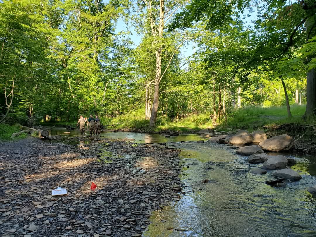
An interesting aspect of headwater stream surveys is the method of fish collection- electrofishing! Electrofishing uses a carefully controlled electrical current to temporarily stun fish as staff wade through the stream, allowing all the fish in a survey area to be collected. Fish are sorted and identified to species, counted, and released back into the stream. Electrofishing is a more effective way to collect fish for surveys than by netting or seining, and is only allowed to be used by professionals.
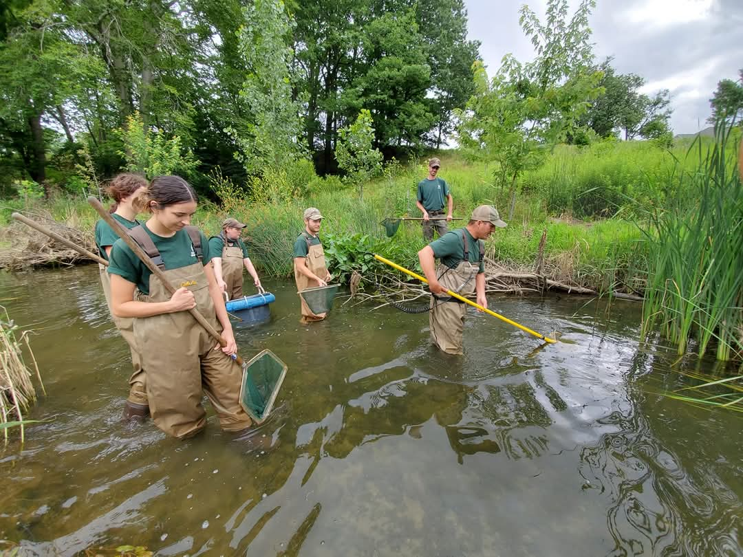
Cleveland Metroparks shares the headwater survey data it collects with the Ohio EPA. It has been used by the state to assign an “aquatic life use designation” to many of the headwater streams in the Park District, which recognizes that they can or do support the expected healthy stream community. We also use this data to identify streams that may benefit from restoration projects, are being impacted by development or run-off from outside of the Park District, or are home to uncommon fish species we want to protect.
-
Primary headwaters are the very smallest streams, but are an extremely important part of a watershed because they are the origins for all of our larger streams and rivers. These tiny streams offer big ecosystem services, including flood control, sediment removal, and habitat for unique native species adapted to living in shallow and often temporary flowing water. There are over one thousand primary headwater streams in Cleveland Metroparks and every single stream has been surveyed at least once. Nearly 200 streams are re-surveyed over a 5-year schedule as part of the long-term primary headwater monitoring program, using Ohio EPA methods that focus on stream habitat, aquatic macroinvertebrates, and salamanders.
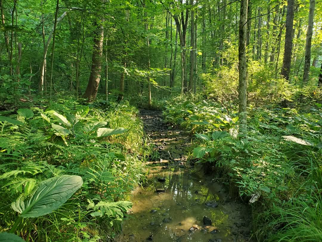
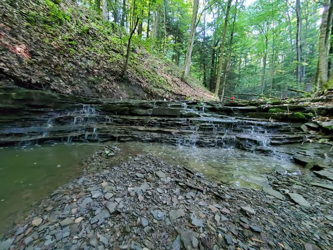
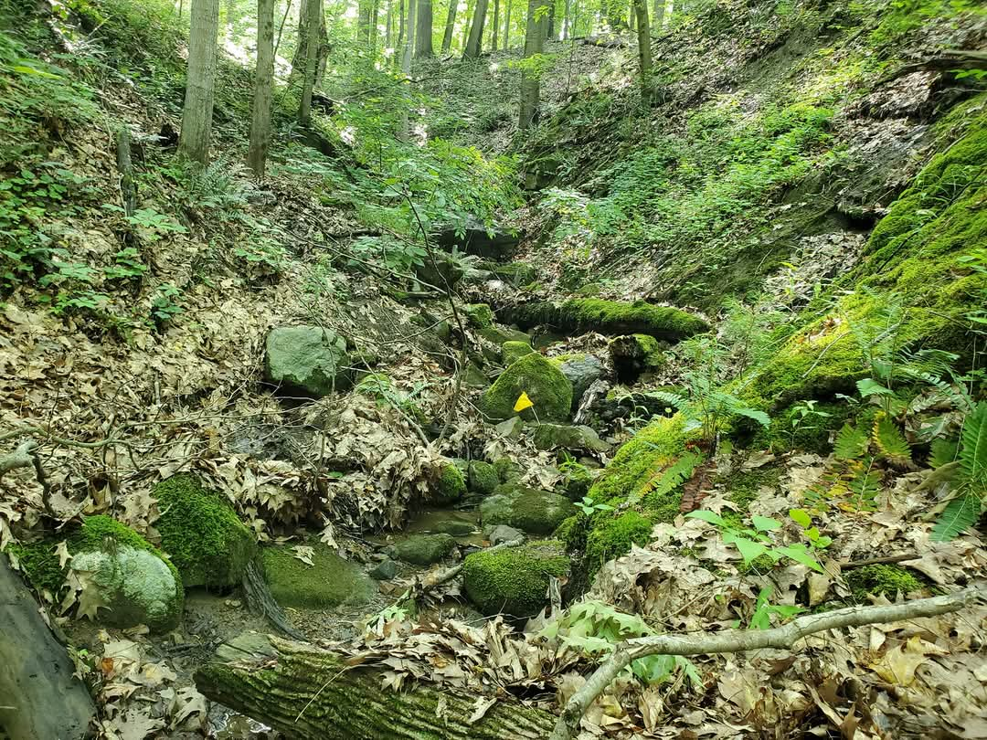
Three images of different primary headwater streams within Cleveland Metroparks
Aquatic macroinvertebrates include a wide range of insects, crustaceans, and even worms and leeches. Each type of macroinvertebrate can provide important information on a stream, from how much of the year it has flowing water to the quality of that water and the condition of the stream habitat. Of particular importance are a group of aquatic insects that are very sensitive to pollution and disturbance called EPT taxa- which includes mayflies, stoneflies, and caddisflies.
Salamander species that rely on streams for reproduction are also an important part of primary headwater surveys. Many of these stream-dependent salamander species have a gilled larval life stage where they need to be in small, flowing stream for up to several years before they mature. Primary headwaters are a critical habitat for these salamanders because they usually do not have deep pools or year-round flow for many fish, which protects young salamanders from becoming fish food! Many of these salamander species have very strict water temperature and habitat needs that can only be found in healthy primary headwaters.
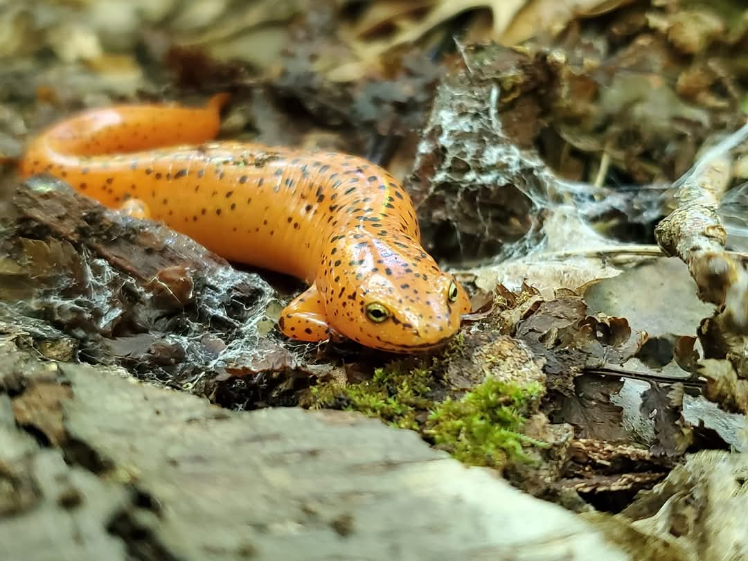
Northern Red Salamander
The goal of our long-term primary headwater monitoring program is to identify changes to the habitats and aquatic communities of our smallest streams throughout the Park District in order to protect and restore them as they are influenced by land use, forest condition, and climate. We use data we’ve collected to help guide management, monitoring, restoration, and research projects throughout Cleveland Metroparks and across our watersheds with partner organizations and agencies.
Technical Reports:
-
Recreational fishing is one of the most popular activities in Cleveland Metroparks. The Park District manages over a dozen fishing areas, from small ponds and lakes to rivers and Lake Erie. Offerings include largemouth bass and sunfish that are seasonally supplemented with stocked rainbow trout and channel catfish for quality year-round fishing opportunities. The Park District maintains an active and extensive fisheries management program.
Fish population surveys are conducted on a five-year cycle via boat electrofishing using standardized techniques and statistical analysis to develop individual management plans for each fishing area Cleveland Metroparks is responsible for. These surveys help characterize population dynamics and the health of recreational fisheries so waterbody-specific management plans can be made.
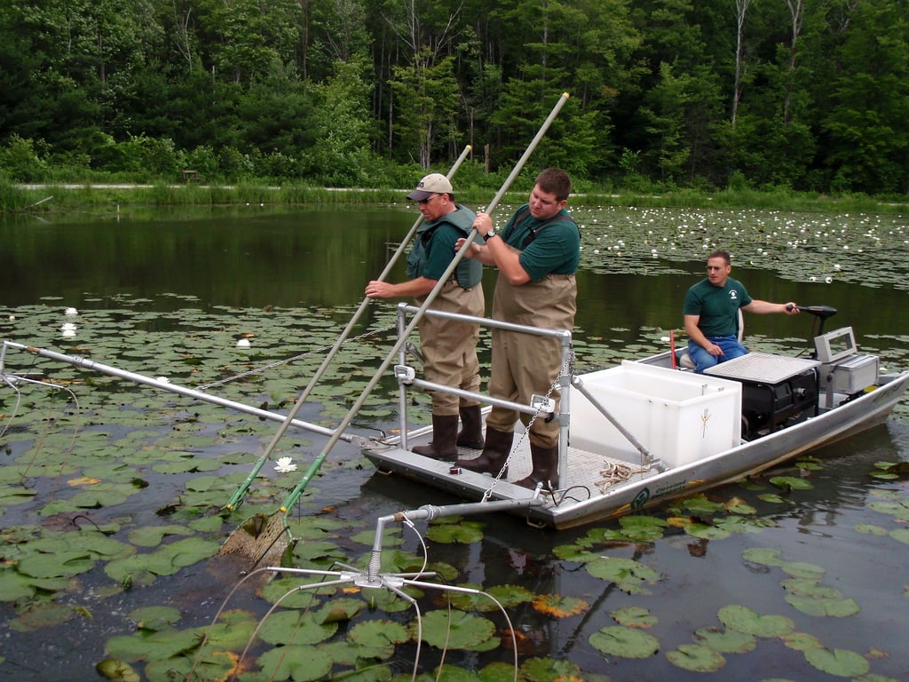
Boat electrofishing is done on timed runs, averaging 30-60 minutes, on transects that focus sampling along structure-rich shorelines. One or two sampling runs are done per waterbody, and fish are then identified to species, counted, weighed, measured, and released back into the water. Statistical calculations reveal information on key sportfish population metrics including age structure, average health and condition, and proportional predator/prey stocking density and balance. This information allows Cleveland Metroparks to maintain and enhance sportfish communities to provide the public with excellent and sustainable fishing opportunities.
Management activities include stocking programs from both in-house and external sources and habitat management, notably aquatic weed and algae control. The overall management goal for our lakes, ponds, and other fishing areas is to maintain and improve the water quality, habitat, and fish community so they can offer high quality, sustainable fishing opportunities for the public.
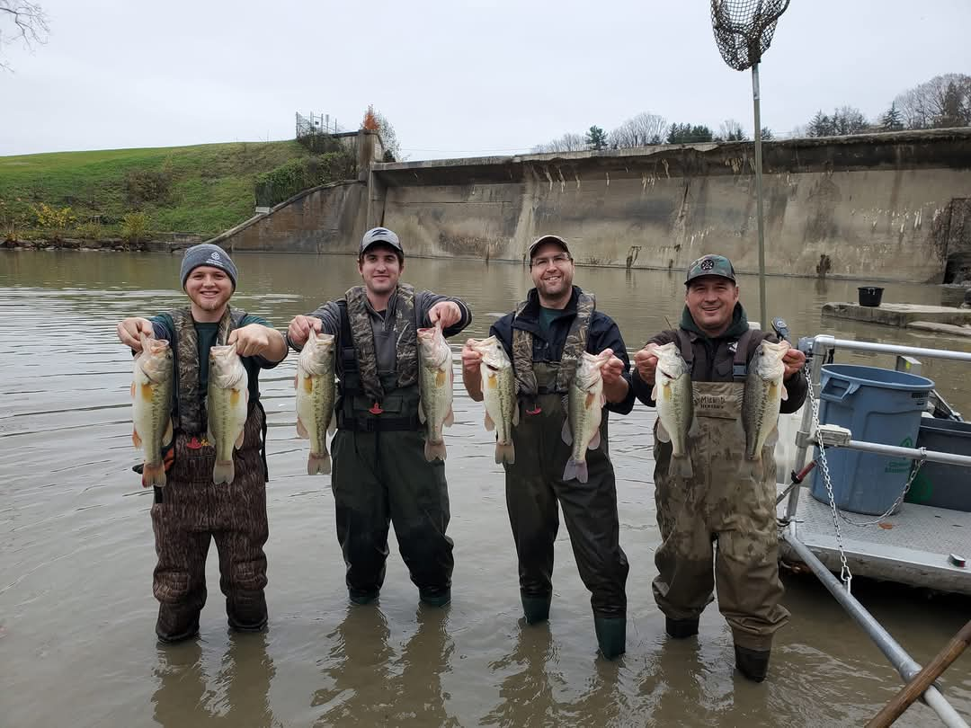
Fisheries Resources
Lake Depth Maps
Acacia Lake Depth Map (2015 data)
Beyer's Pond Depth Map (2015 data)
Hinckley Lake Depth Map (2015 data)
Judge's Lake Depth Map (2015 data)
Ledge Lake Depth Map (2015 data)
Ranger Lake Depth Map (2015 data)
Shadow Lake Depth Map (2015 data)
Wallace Lake Depth Map (2015 data)
Lake Management Plans
-
Cleveland Metroparks inventories and monitors wetlands throughout the park system as part of its commitment to track long-term changes in ecosystem health. Wetlands provide a variety of ecosystem services in the form of flood mitigation, water quality maintenance and improvement, and high-quality recreational opportunities. Given that a considerable amount of acreage within Cleveland Metroparks is adjacent to streams and rivers, wetlands in the park system play a critical role in maintaining the health of local waterways.
Supported by a USEPA Wetland Program Development Grant, staff in the Natural Resources Division initiated an inventory of wetlands in 2012. That multi-year effort resulted in the identification of more than 3,200 individual wetlands totaling over 3,500 acres. The quality of these wetlands was assessed using the Ohio Rapid Assessment Methods for Wetlands (ORAM). The results suggest that most wetlands in Cleveland Metroparks fall into “Category 2” meaning that they provide moderate levels of ecosystem functions and services. Additionally, many high-quality wetlands (i.e., “Category 3”) that provide high levels of important functions and services were identified throughout the park system. Protecting these high-quality resources from degradation is a priority for Cleveland Metroparks.
image
A variety of other data on specific aspects of wetlands have also contributed to our understanding of wetland health. Plants, amphibians, and hydrology are a few examples of wetland attributes that are studied in Cleveland Metroparks. These focused investigations help us understand more about how wetlands in the park system contribute to local and regional conservation efforts.
The long-term objective of wetland monitoring in Cleveland Metroparks is to provide updated status and trends information on wetland occurrence and health. This information is critical to planning development and recreation activities in the park system in a way that minimizes negative impacts to wetland ecosystems.
